TAK Article TAK Logo
The Team Awareness Kit (TAK) is a geospatial mapping tool that is improving how law enforcement and other public safety personnel operate. Originally developed at the U.S. Air Force Research Laboratory as the Tactical Assault Kit, TAK was refined over several years by Special Operations Forces and warfighters through actual. It has been adapted to suit the operations of agencies at the local, state, and federal levels. A civilian version of the software is available, too.

TAK was originally developed by the Air Force Research Laboratory for use by special operations forces (Credit: US Navy).
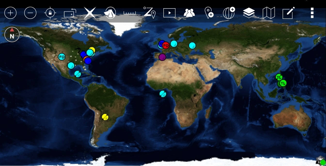
There is a long-standing need for a common situational awareness (S.A.) platform for all public safety. The system includes a key personnel accountability feature. It integrates with the smartphones and tablets already in use by public safety, turning them into mission planning and blue force tracking (BFT) tools.
/span>
Features
One of the key features of TAK is its ability to provide unified S.A. Knowing who is where during a crisis is paramount. TAK addresses this need by integrating personnel accountability, mission planning, and BFT into a single platform. TAK offers ground and enhanced air situational awareness with positional overlays of assets. It can be integrated with the use of unmanned aerial systems (UAS). It greatly enhances public safety collaboration.

TAK provides ground and enhanced air situational awareness with positional overlays of assets. It can be integrated with unmanned aerial systems (UAS) (Credit: Cpl Janessa Pon, USMC).
This package enhances situational awareness by enabling users to track the locations of their mission associates regardless of their organization. It also enhances communication capabilities through an array of applications.
TAK stands out from other applications due to its interoperability. While many applications exist for BFT and mission planning, very few of them can communicate with each other. TAK addresses this issue by using a central hub, the TAK Server, to ensure all S.A. data has a single focal point, thereby ensuring uniformity.
It supports a “plug-in” architecture, which allows non-native communications provided by external communications devices (e.g., SATCOM, MANET, etc.) to interface with TAK. This feature allows TAK to be used with a variety of technologies to solve many of the current communication issues encountered by end users.
Capabilities
TAK boasts a wide array of capabilities. It supports both online and offline mapping in most standard formats, with the added convenience of downloading maps directly within the TAK app. It facilitates (BFT) tracking and collaborative mapping, which includes points, drawings, and locations of interest. Users can import and display KML, KMZ, and GeoPDF overlays.
Here’s the ATAK-CIV on an Android phone. This is the general public version of the software. TAK has both government and public versions, each with global capabilities. (Credit: FieldMapper / CC BY-SA 4.0 DEED)
The app allows for location marking and sharing, complete with photo tagging. It enhances communication through chat, file sharing, and photo-sharing features. Live video streaming is also available, with the option to share video links.
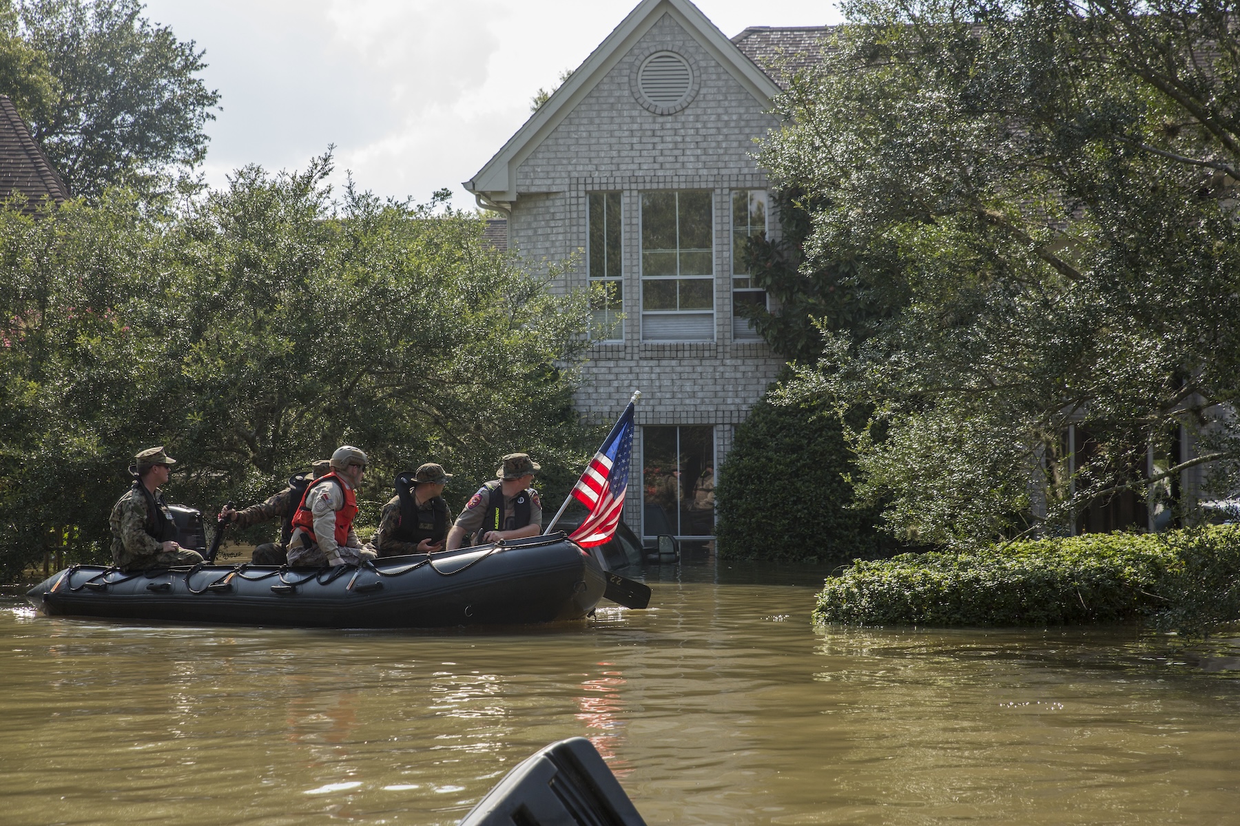
Marines along with a member of the Texas Highway Patrol and Texas State Guard, patrol past a flooded house in Houston after Hurricane Harvey. DHS personnel and state/local entities have used TAK for disaster response planning and execution since the 2017 hurricane season (Credit: Cpl Niles Lee, USMC Forces Reserve).
The spotted map feature enables users to mark and share multiple locations across their map. A digital pointer allows for rapid marking and sharing of items on the map with your team. The app supports ground navigation and is also useful for flying and air-ground coordination.
Users can center on themselves or other objects, such as another person in the network. The app includes range and bearing measurement tools, team emergency beacons, a customizable toolbar, and a 3D perspective view.
All data is secured and fully compatible with the TAK ecosystem.
DHS TAK Program
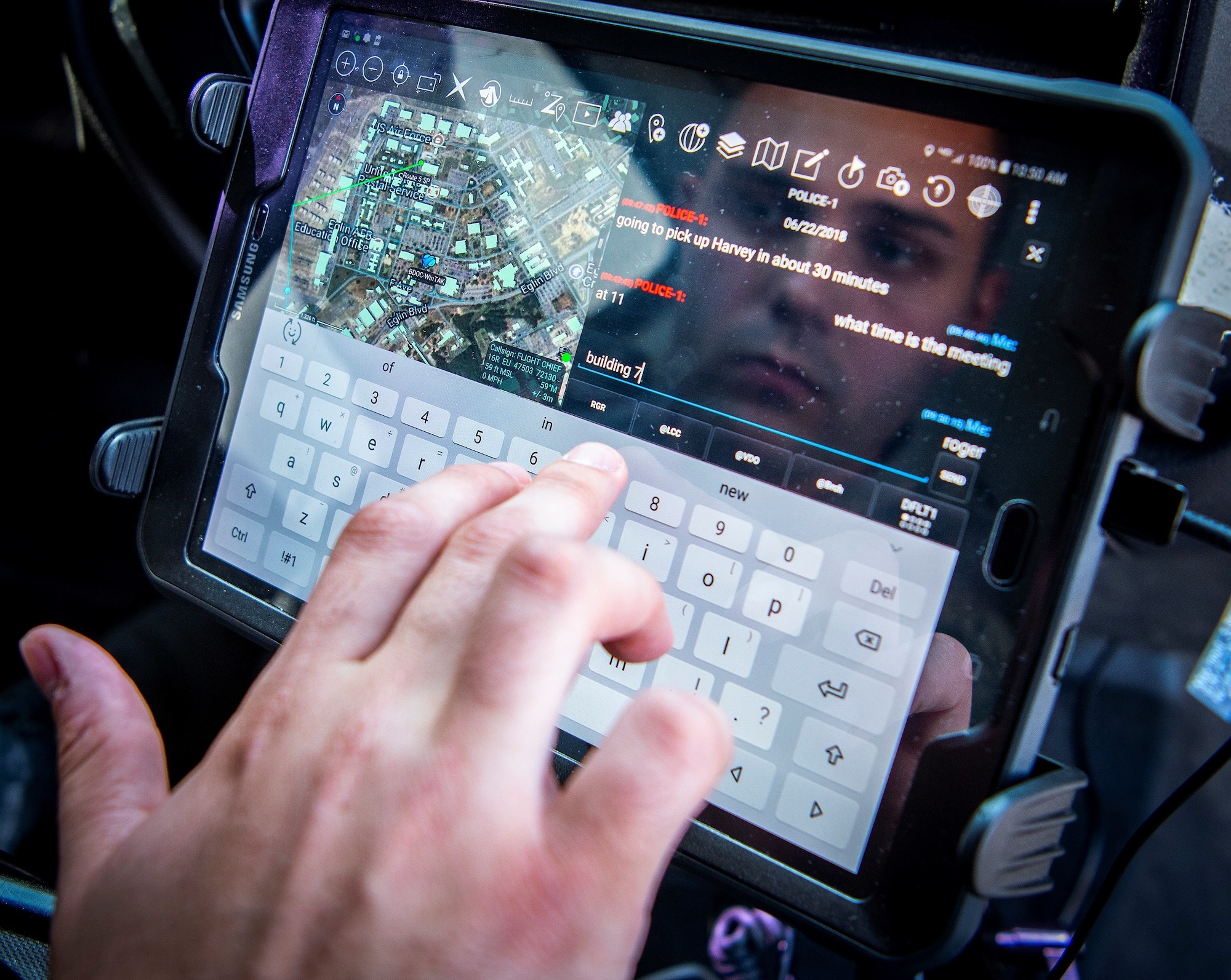
A 96th Security Forces Squadron MP using the TAK system to send a message from his patrol vehicle (Credit: Samuel King Jr, USAF).
The Department of Homeland Security (DHS) has leveraged TAK to support federal agency response during natural disasters and coordinated operations. TAK clients use the native communications built into the hardware (e.g., cellular, Wi-Fi, etc.) to pass data across an existing network to the TAK server.
The DHS has incorporated TAK into various components of its operations, enhancing situational awareness for routine operations, special events, and disaster responses.
In the past half-decade, the DHS Science and Technology Directorate (S&T) has effectively utilized this system to aid federal agency response during natural disasters and coordinated operations. TAK is currently transitioning across DHS components and is poised to become the DHS-wide solution for tactical awareness.
Since the 2017 hurricane season, DHS personnel and state/local entities have used TAK for disaster response planning and execution. It was employed to coordinate rescue and security operations for Hurricanes Harvey, Irma, and Maria. It was also used in response to Hurricanes Florence, Lane, Michael, and Dorian in 2018-2019. It has been estimated that over 2,000 lives were saved.
Data Security
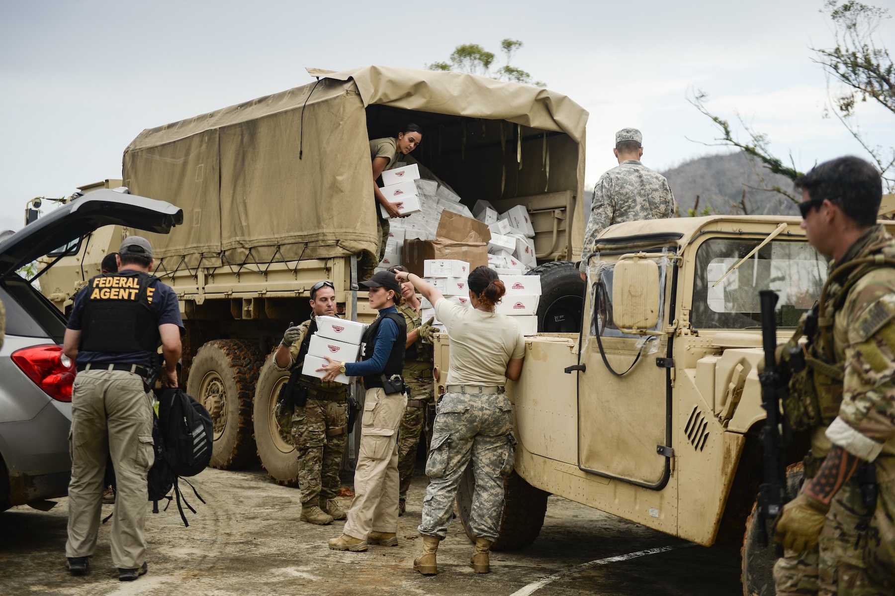
Hurricane Maria brought Army Reservists, U.S. Coast Guard Investigative Service and Tactical Law Enforcement Team members, Treasury Department agents, and Puerto Rico Ports Authority agents to deliver aid and supplies in October 2017. (U.S. Air Force photo by Master Sgt. Joshua L. DeMotts)
TAK ensures data security through a combination of secure data storage and transmission methods. The TAK Server plays a crucial role in this process. It secures and stores data in both standalone and federated configurations. This is required whenever TAK clients are not operating in a peer-to-peer network, or there is an operational need to encrypt and store mission data. Client plug-ins, such as DataSync and Execution Checklist(ExCheck), also require the TAK Server, contributing to the overall data security in the TAK system. The server’s ability to broker data ensures that only authorized users can access the information, thereby maintaining the confidentiality and integrity of the data. The full TAK Server has been released and open-sourced to the public and is available for download.
Product Lines
TAK offers various products tailored to different platforms and user needs. These include, but are not limited to, the Android® Team Awareness Kit (ATAK), the iOS® iTAK app, and the Windows® Team Awareness Kit (WinTAK) app. Each of these products offers a robust moving map, imagery/terrain analytics, enhanced collaboration, BFT, and overall communication and situational integration. Military, government, and civilian versions are available. There are also various plug-ins.
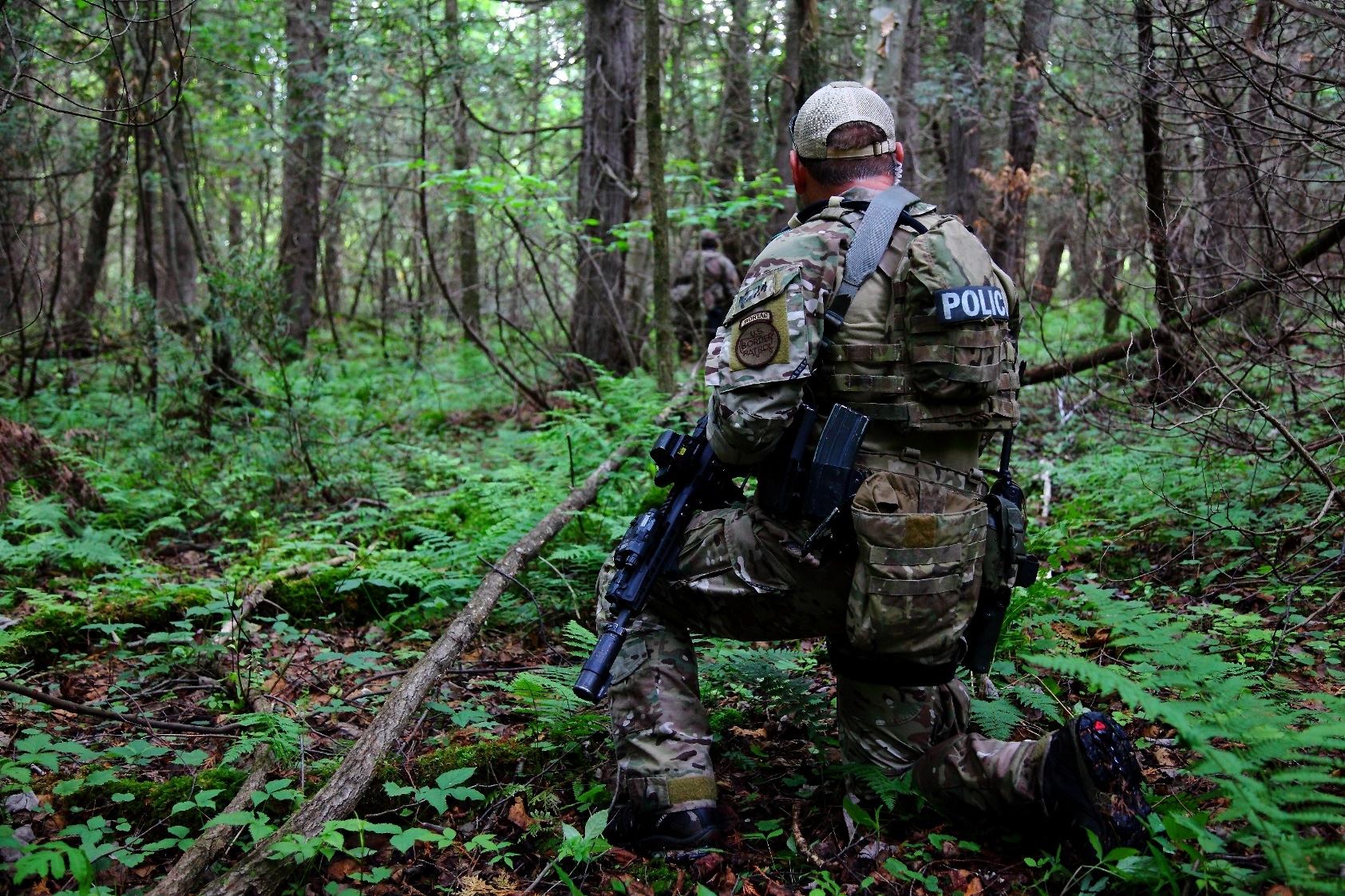
A Border Patrol Tactical Unit (BORTAC) team member communicates with his team during manhunt. The Department of Homeland Security (DHS) of which the Border Patrol is part, is one of the many agencies using TAK. (Credit: Kristoffer Grogan, US-CBP).
Cost
TAK is a Government-off-the-Shelf (GOTS) software application available from the U.S. Government at no cost. However, while the software itself is free for government and public safety use, it requires hardware to run (like a server, mobile device, etc.) and technical support to install and maintain the software. For these reasons, the overall cost of implementing TAK can vary. The civilian/recreational versions are also free.
Summary
The Team Awareness Kit (TAK) is a powerful tool that has significantly enhanced the capabilities of law enforcement and other public safety personnel. By providing unified situational awareness, facilitating interoperability, and offering extensibility with plug-ins, TAK is truly a game-changer in the field.
Resources: